-
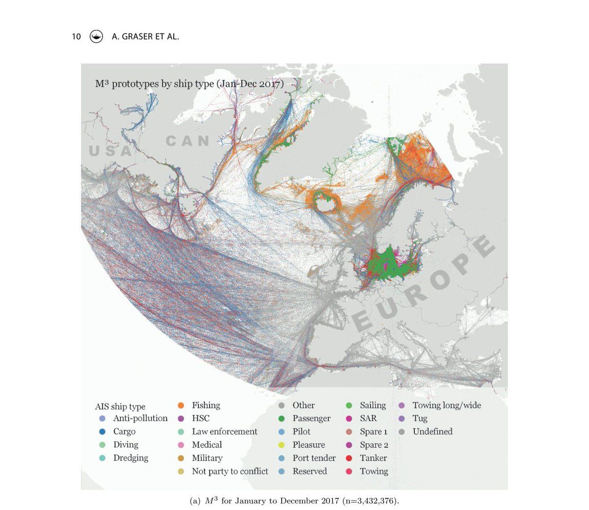
🎈🎈🎈 Our new IJGIS paper on exploring ship tracking datasets consisting of billions of locations is out now! 🎈🎈🎈 ⛵🛥🚤⛴🛳🚢 tandfonline.com/doi/full/10.1080/13658816.2020.1776293 #GISChat
-
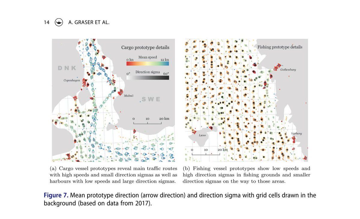
We use #Spark and #GeoMesa to aggregate ship AIS records. The case study uses 4 billion records. Each record is matched to a prototype that models local movement properties (location, speed & direction distribution). The whole process takes just 41 min on our in-house cluster.

