-
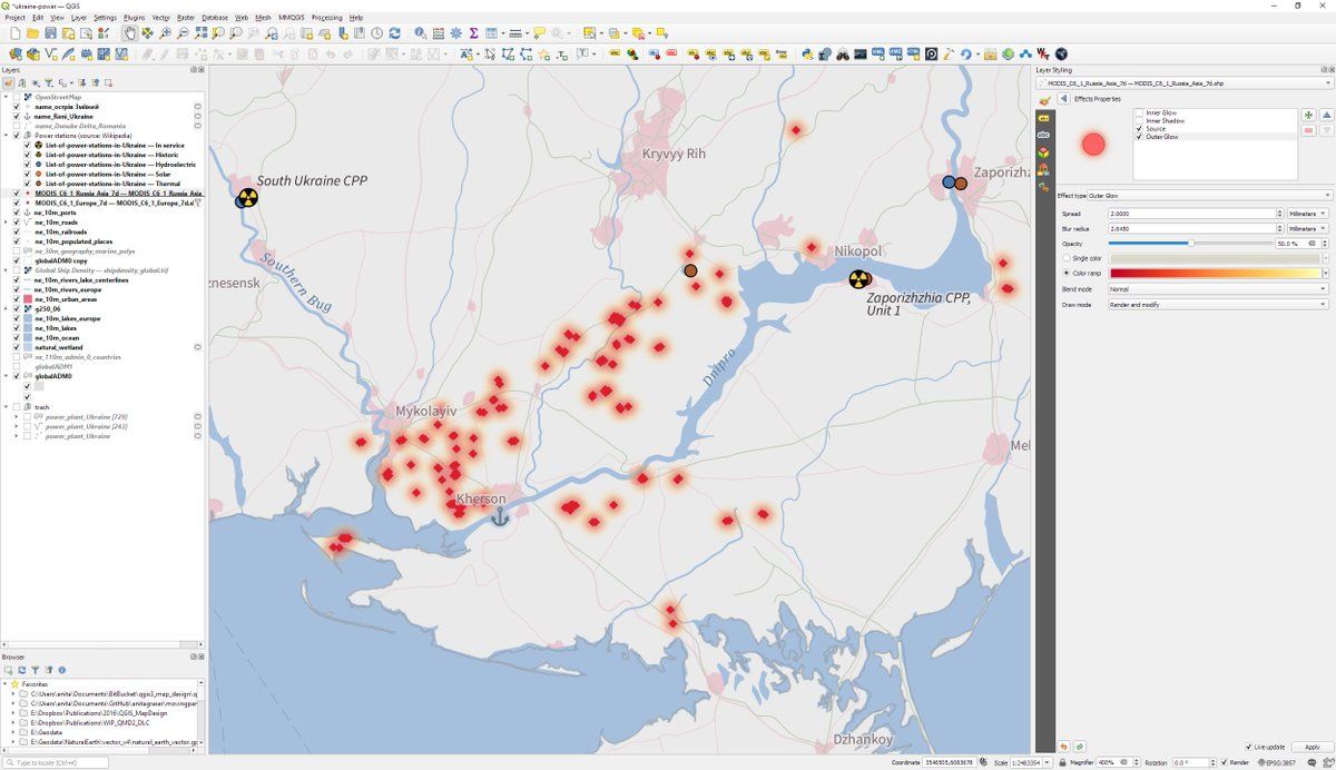
Mapping #MODIS 🔥 data using #QGIS color ramp glow effects to see what's going onPermalink On twitter.com
 ♻️ 4 Retweets
❤️ 63 Favorites
Mood 0
♻️ 4 Retweets
❤️ 63 Favorites
Mood 0
-
Live Nasa map: firms.modaps.eosdis.nasa.gov/map/#d:24hrs;@34.2,45.3,6z Downloads: firms.modaps.eosdis.nasa.gov/active_fire/Permalink On twitter.com
❤️ 5 Favorites
Mood 0
-
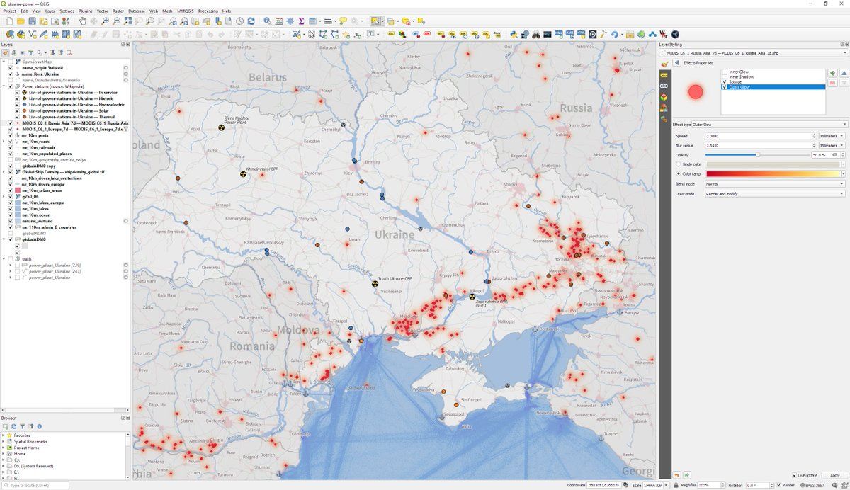
Full map:On twitter.com
 ♻️ 1 Retweets
❤️ 16 Favorites
Mood 0
♻️ 1 Retweets
❤️ 16 Favorites
Mood 0
-
I'll need to figure out how to post these screenshots in better quality. For now, you can find the full res screenshots in the QGIS Flickr group: flickr.com/photos/48244569@N02/52220624402/in/pool-qgis-screenshots/Permalink On twitter.com
♻️ 1 Retweets
❤️ 3 Favorites
Mood +4 🙂
-
Still needs better / more intuitive symbols for hydro, thermal, and solar power plants. Any pointers #gischat?Permalink On twitter.com
♻️ 2 Retweets
❤️ 4 Favorites
Mood +2 🙂